|
HAWAII VACATION MARCH 2008 - PART 2 - KAUAI -START
One of the really nice features of the Elder hostel was the insight regarding Hawaii's geological history that our Geologist gave to us during one of our field trips. So I thought I would include a few maps , and pass on some of the fascinating geologic history of the Hawaiian Island chain before we move on to the photos.
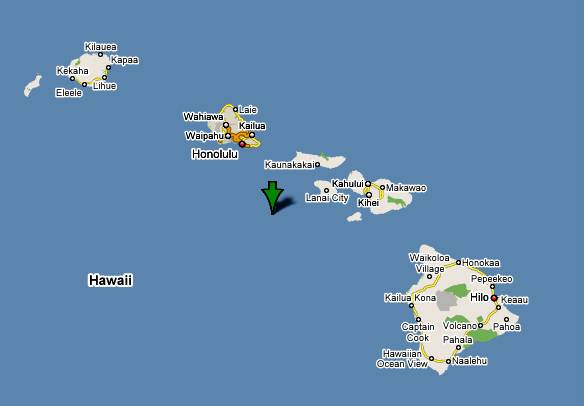
This overview map depicts the major islands in the Hawaiian chain. Kauai is the island at the top left, and Oahu, the most populous by far, is next to it. The island of Hawaii, sometimes called "The Big Island, is the largest. It is shown in the lower right corner.
The chain extends for several thousand miles further to the Northwest, containing many thousands of islands, almost all are very small and uninhabited.
The ocean floor in this part of the Pacific Ocean is mostly flat and many thousands of feet deep. All of the islands in the chain were created by volcanic action over may millions of years. So, the islands are really the tops of very large mountains . In fact, the volcanic mountain which is on the Big Island, is much larger than Mount Everest, since it is much higher than the surrounding terrain. The oldest islands are towards the Northwest, and the youngest are towards the Southeast. This explains why the Big Island has very large new lava flows.
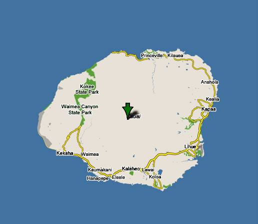
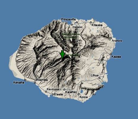
This is the island of Kauai, which is oldest of the larger Hawaiian islands. As a result, it has been worn down by erosion much more than the other large islands. So, there is no longer a volcanic peak, but a lot of very rough terrain where the peak had been. The roughest terrain is in the Northern part of the island. It is so rough that that no road could be built along a portion of the shore, and so it is not possible to drive completely around the whole island.
For reference, the capitol and airport are in that cluster in the South East corner of the island in the small town of Lihue, and out hotel was about 10 miles up the East coast road near a very small town of Wailua.
Here is Google's terrain map that clearly shows how rough the center and North parts are.
Another fascinating fact is that the high central area has an average rainfall of over 400 inches per year, reported to be the wettest spot in the world world. A recent year had over 700 inches! It is only fair to report that the areas nearer to the coast only average around 60 inches per year. So there is a lot of water available on the island for agriculture, which is irrigated in some areas.
Now we know the reason why it is called the "Garden Island"!
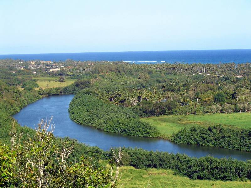
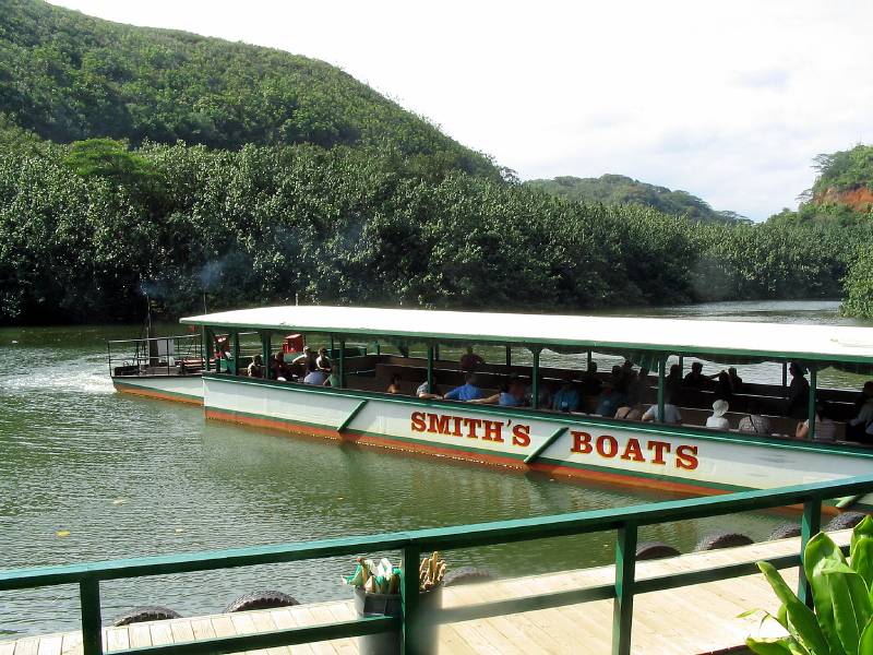
This is a view of the Wailua River, the only navigable river on Kauai. As you can see , there is a large delta where the river meets the ocean. Our hotel is right hear the junction of the river and the sea.
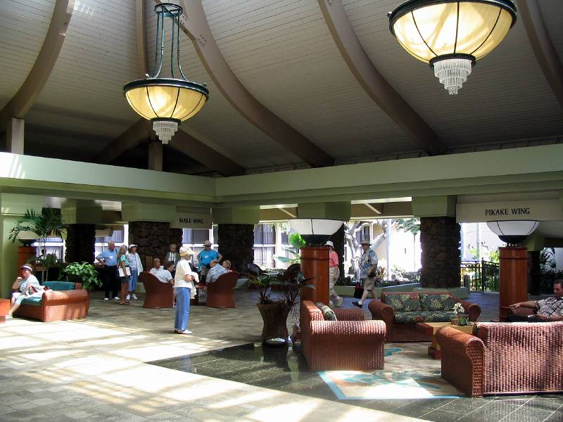
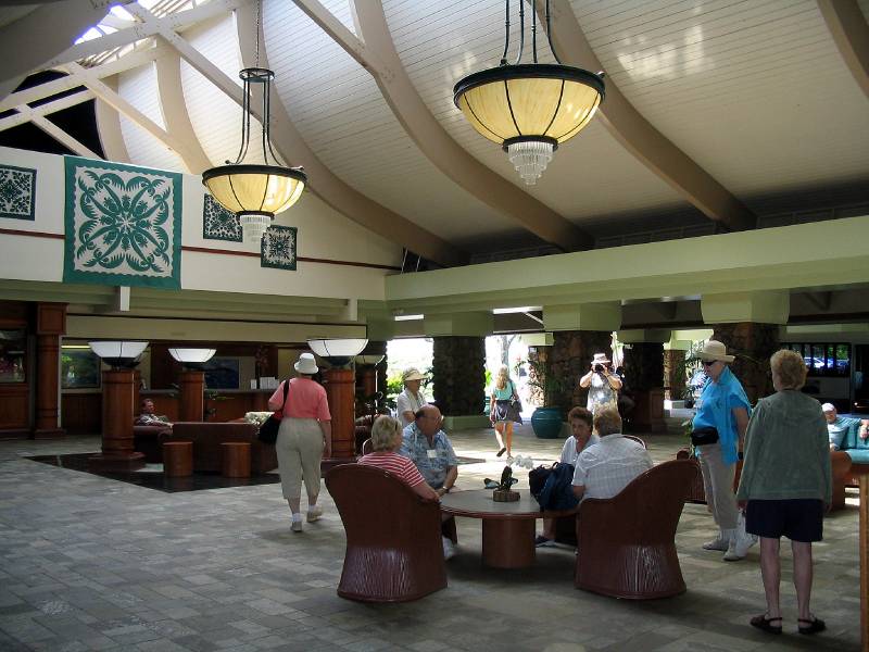
This is the lobby at the hotel. It is very large and is completely open on three sides, allowing wonderful breezes to flow across it. I just love the design, and I loved to sit on one of the plush chairs looking out towards the sea. Our Elder hostel group are assembling, to await the bus to take us for a cruise on the nearby Wailua River. I think that is Marie in the center of the photo
The view in another direction.
On Sunday evening we had dinner and an orientation meeting where we met our coordinator, Linda, and then we each stood up and told a little about ourselves. Would you believe that there were two other people from the Pittsburgh area! So we chatted. for a while.
On Monday morning we had two lectures regarding the history of the Hawaiians and a comprehensive overview of the language and it's history. Since the Hawaiians did not have any written language, the missionaries designed one so they could read a translated bible.
Looking towards the sea from the lobby
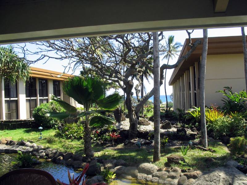
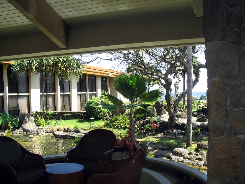
This was my favorite spot to relax and maybe make cell phone calls back to the family.
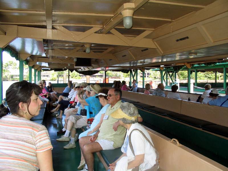
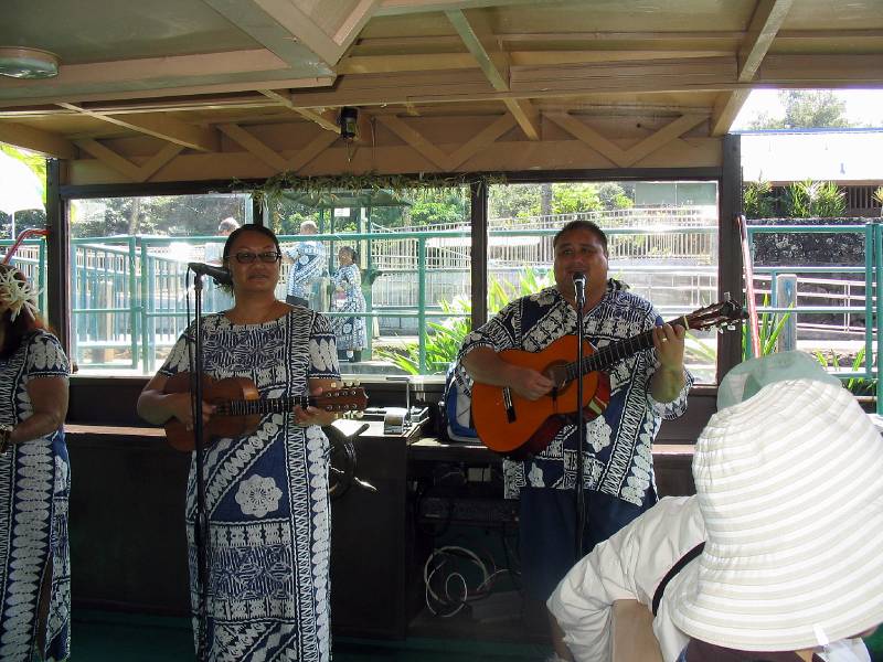
And here we are relaxing on the river cruise boat, preparing to head to the Fern Grotto.
We had some very nice entertainment on the trip to the grotto In addition to the musicians, there was a very pretty and talented Hula Dancer, but I don't have a photo of her. I guess I was distracted and not paying attention to my photo duties.
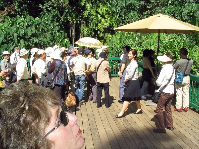
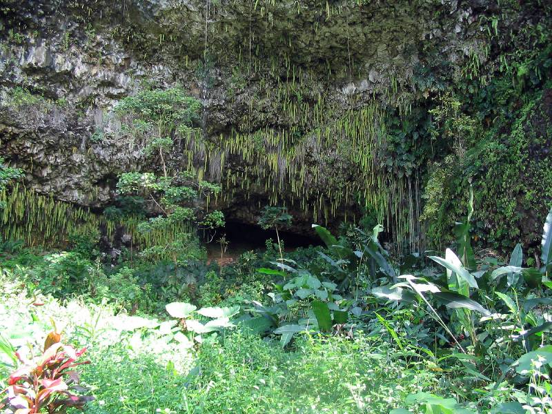
After about a 30 minute boat ride, we debarked , and walked through a lush tropical woods to this grotto area.
What we see is a very high vertical cliff, and there are springs exuding water higher on the cliff, and a very lush assortment of ferns are growing in the crevaces and hanging down the face of the cliff.
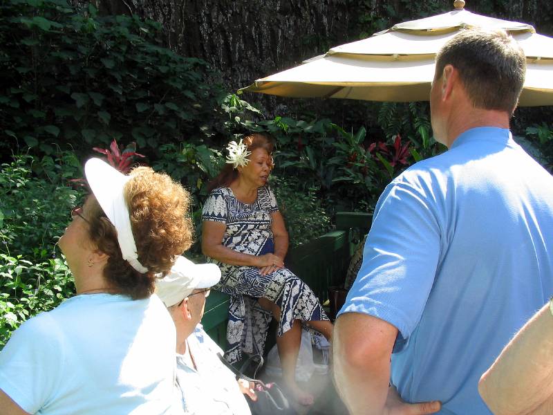
The narrator is describing the history of this grotto, and pointing out that there were two major hurricanes that hit this area near the end of the last century, wreaking havoc in many parts of the island. This area is devastated, and is gradually getting back to its former splendor. This is one of the major Tourist sites, and I remember that one of my cousins was showing me photos of this place, because she had brought her whole wedding party here to be married!! What a surprise to me.
We are now walking back to the boat for the return trip.
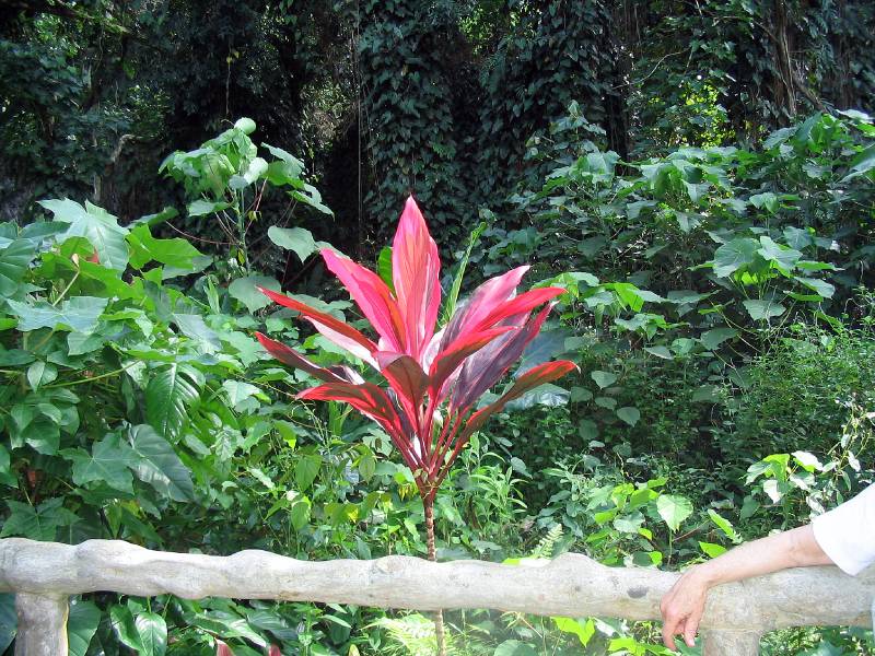
Some samples of the lush vegetation in the area
And more of nature's beauty.
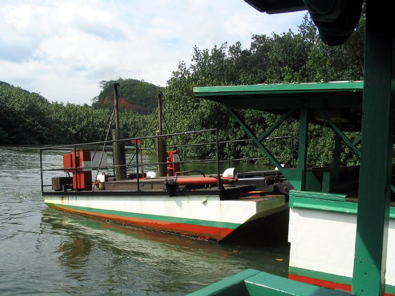
This is a large operation with many boats.
The engineer in me was intrigued by the fact that the boats did not contain their own propulsion system. They were propelled by these cute little remotely controlled pusher tugs.
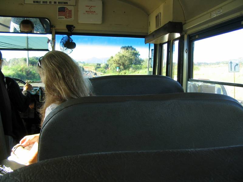
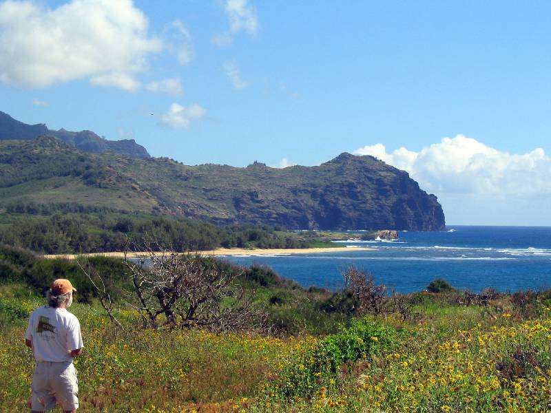
It is Tuesday and we are in our yellow school bus en route to an exploration of the South Coast.
That is Linda, our coordinator sitting in the front of the bus. She has had some interesting experiences that she shared with us. For example, she came here on her honeymoon many years ago, and they fell in love with Kauai. So much so that the went back home, quit everything, and six months later, moved here. They saw a small beach hotel for sale, and on impulse, bought it! After years of struggle, they gave it up, and she studied to become one of the expert teachers of the Hawaiian language. She was the one who taught our language class, and each day on the bus she made us learn new words!! And she periodically diverted the bus to see something that she especially loved.
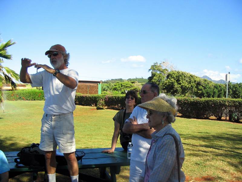
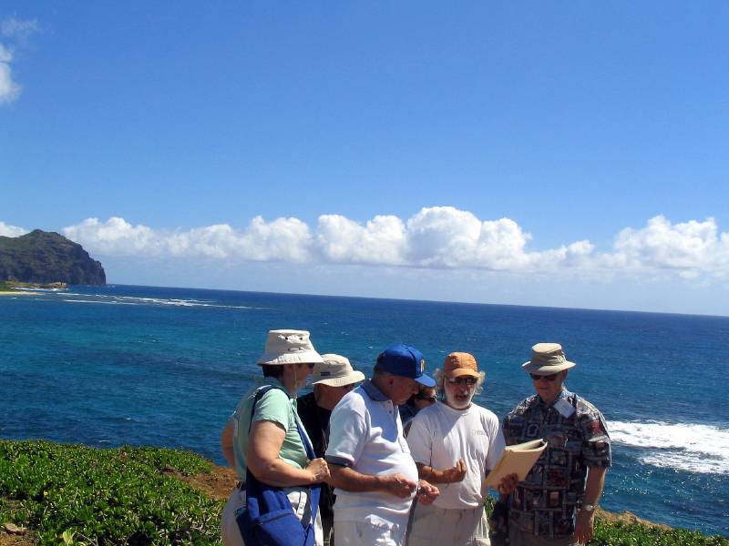
Our geology professor, Chuck, who was also captured by Kauai, is telling us the fascinating geologic history of the island and more particularly, the south shore.
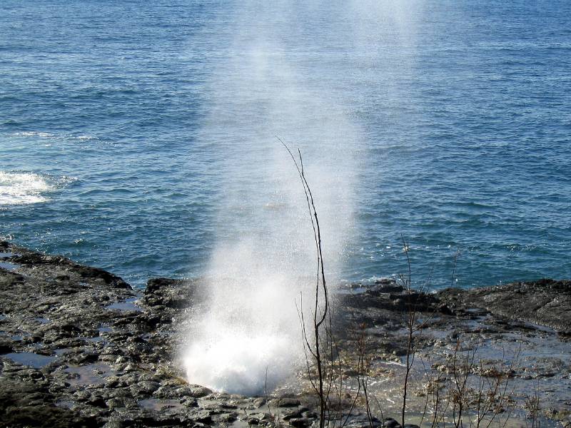
There are many blow holes in Hawaii and elsewhere, but the internal shape of this one is unique, causing it to give out a loud musical sound as the water first forces air through the hole.
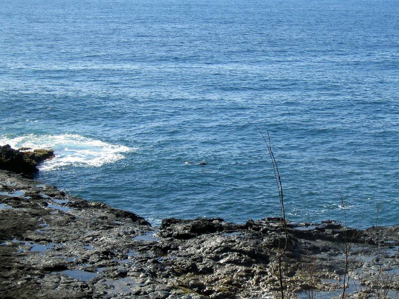
If you look really carefully, you may see two large turtles swimming in the water just to the right of the white watter. A few moments later they were engaged in passionate love making. I did not get a photo of that to show. sorry.
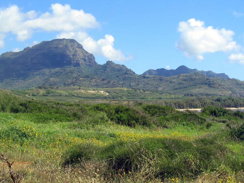
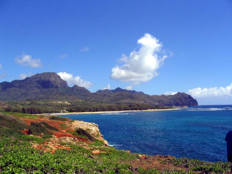
This is a beautiful large bay with a glistening white sand beach. Chuck said that since the island is entirely volcanic, the only truly native sand would be black. However, the chemical composition of this lava sand slowly dissolves in the ocean water. He explained that the white sand comes from coral reefs, which over time , disintegrate into sand and wash ashore. Now aren't you glad you know that?
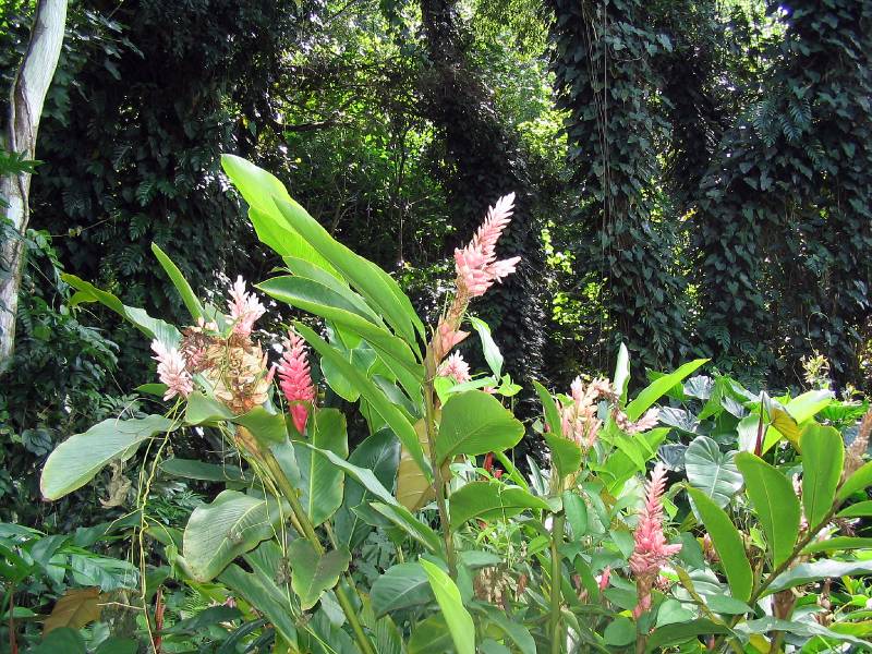
What do you think of all those wild flowers??
The interestingly shaped mountains that we see have all, or mostly all, been given interesting names, such as "Sleeping Queen Victoria" - I made this one up, but you get the idea.
Chuck also said that there was once a large battle here when the King of Oahu came with an armada of war canoes to try and force the Kauai King to submit. I think the Kauai King later voluntarily joined the Oahu King, and all the islands were then united.
Notice all of the beautiful wild flowers! This is all part of a large plantation that allows this access onto their property.
Another view.
It is delightful to go out to such a beautiful location to learn about our wondrous world!
Kauai was the home of many large sugar plantations until relatively recently, when, when, due to the relatively short supply of labor, and the high cost, they could no longer compete with cheap overseas competition. I believe that there is only one or two plantations still in operation.
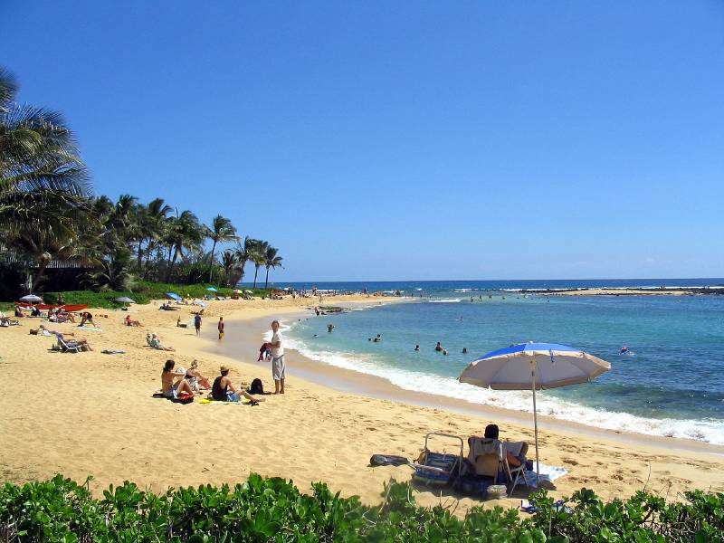
As a consequence, there is great pressure to develop the land and build many time share or condos. This is the subject of a lot of conflict between those who want to preserve this "Garden Island" and those who want to develop. We are now in an area where some development has occurred, with beautiful beaches and lush gardens.
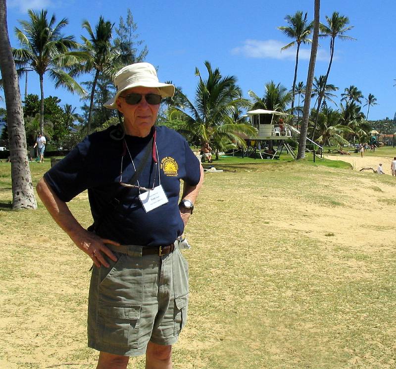
One of the really nice things that occurs when the Elderhostel is over, is that I no longer have to wear the Name tag around my neck. It really gets bad when I also have two pair of glasses and a camera case around my neck. But it is all worth it.
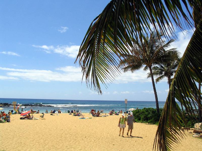
South Shore Poipu Beach
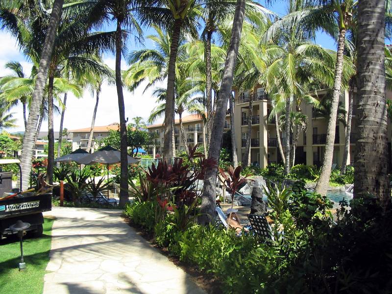
Here is a large fancy Time Share Condo. As Marie and I were walking along their beach front path a charming young man asked if he could help us. Before we knew it, we were being given a guided tour of the place, and encouraged to go into the office to learn more about the "wonderful opportunities" available. But we are battle hardened old geezers, and slipped out of his grasp.
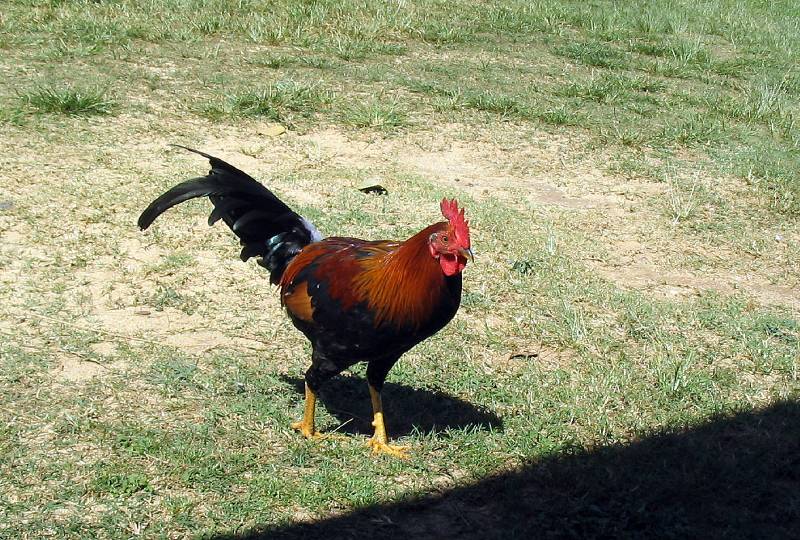
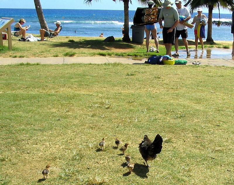
This island is the home of thousands and thousands of various breeds of chickens, all living in the wild. The apparently all got loose during the hurricanes, and they have been enjoying their freedom. When I asked if anyone catches them for food, I was told that it was much easier to just get a chicken in the market.
See, I told you that they were having lots of fun here in paradise!
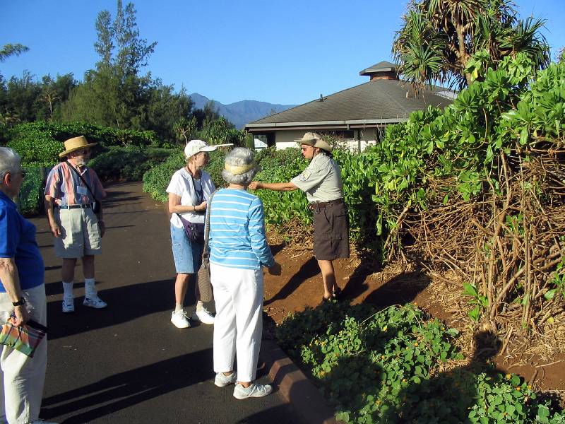
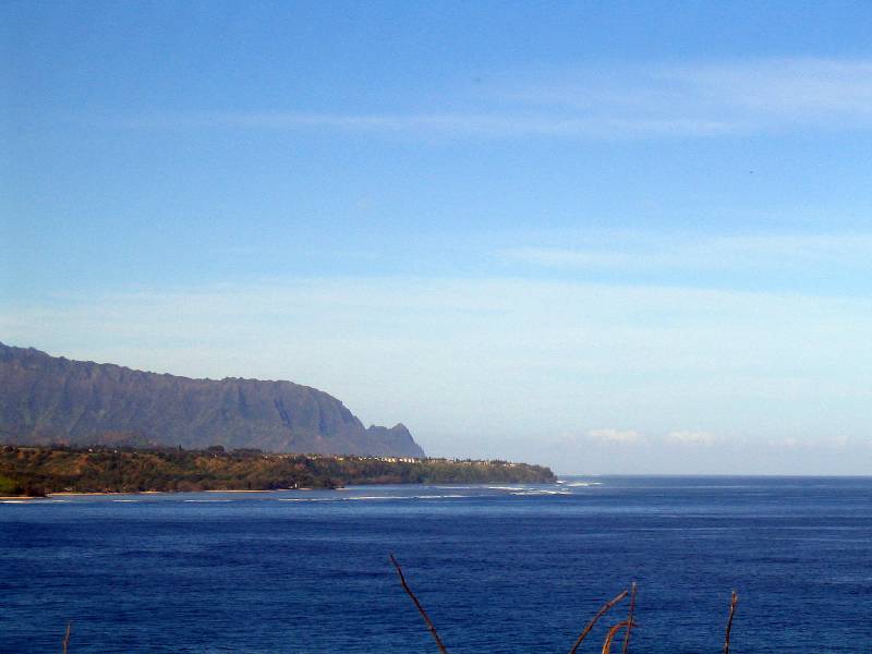
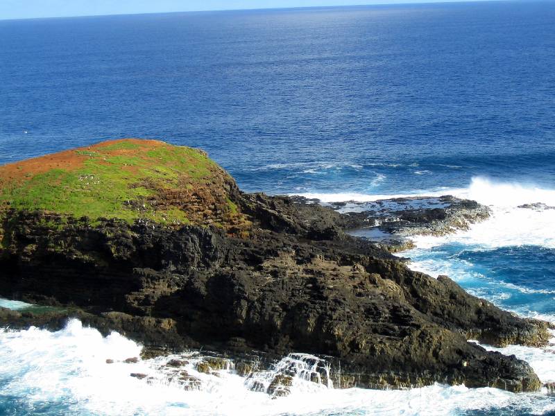
It is now Wednesday, and we are en route up the west side of the island to visit the North Shore., enjoying the highlights en route. Our first stop is here at Kilauea Point National Wildlife Refuge, which is on a long high peninsula sticking out into the sea. Here, the park ranger is describing its features and wildlife.
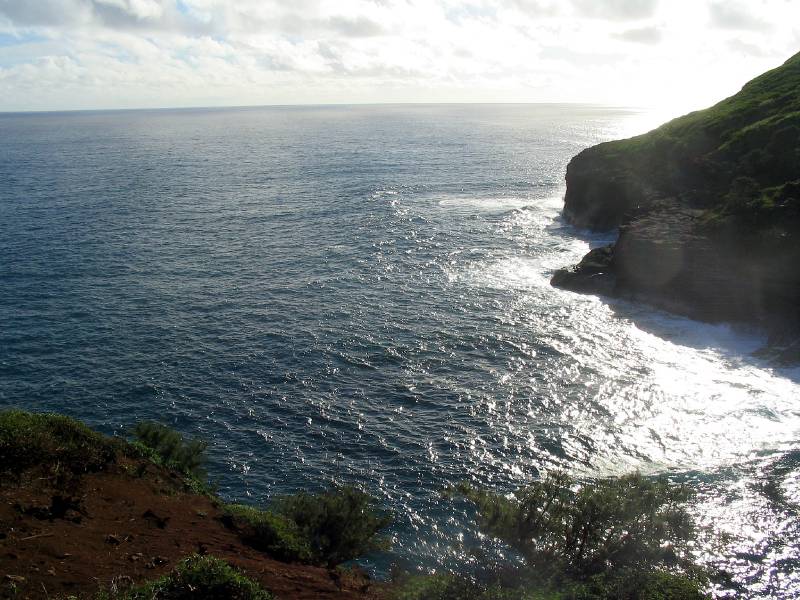
The view to the East
And the view to the Northwest. It is a very popular stop off for many species of sea birds.
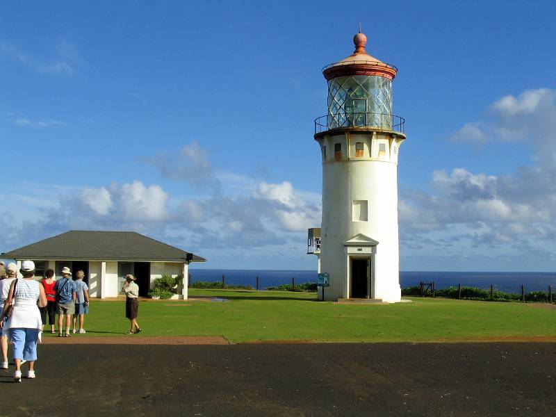
This high peninsula point was a perfect spot for a lighthouse, which was a very important navigation aid in the early days, but it has been deactivated for years. There is a small navigation aid that you can see behind it, but these days most people use GPS.
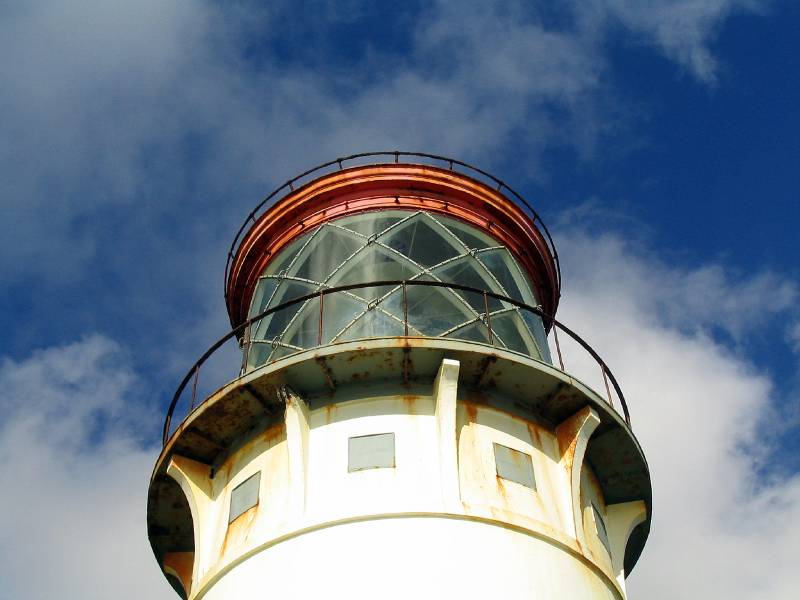
The huge Fresnel Lens was reputed to be one of the largest in the world. Bringing it up the high cliffs, along with the other building supplies was a big challenge.
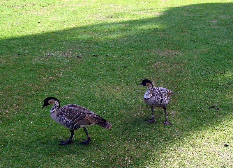
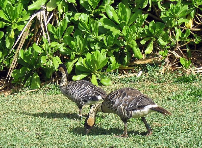
These are an endangered species of native Hawaiian bird. There were no predators when these birds were evolving here, so they did not need the ability to fly. There is a big effort to save them, and they are a feature of this refuge. We were advised to watch where we walk, as you can see they leave a lot of little piles on the lawn.
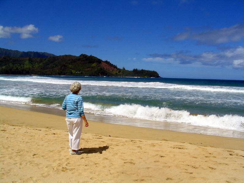
Looking down at the surging waves.
Another view to the Northwest.
They are not spooked by people at all., so they must have been an easy food source for the early inhabitants.
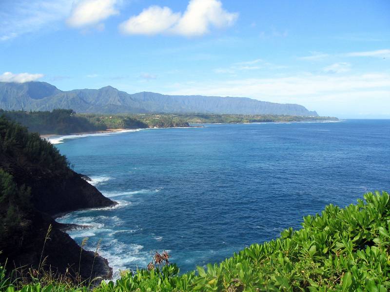
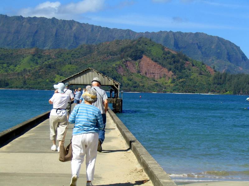
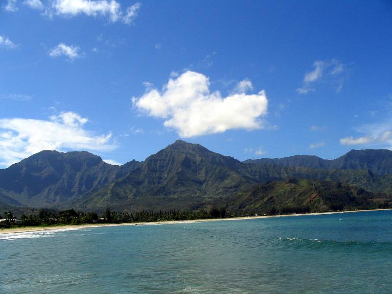
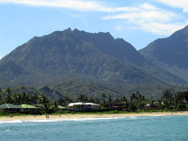
This is the pier at Hanalei Bay on the north shore. There is a beautiful beach here, and when I saw it and the mountains across the bay, I thought that it must be the place where the movie "South Pacific" was filmed. Our coordinator said that a lot was shot in Hawaii, but she is not sure what was done where.
Stunning on a day like this. You may wonder how we had 7 days of great sunny days in a rainy place like Kauai. Well we wondered also, but I guess we were lucky.
A surfing class very near to the pier.
I just love the mixture of the tropical beach with the mountains in the background.
Ah! so beautiful. and the wonderful breezes!
Heading back to the bus.
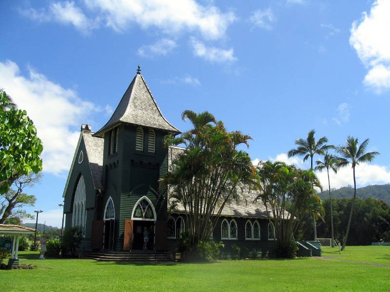
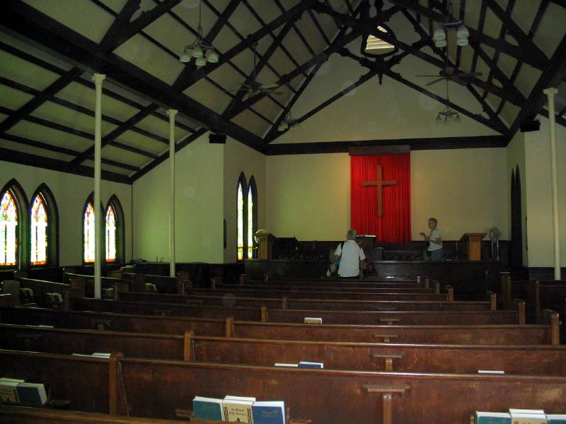
One of the beautiful old churches.
And so quiet and peaceful.
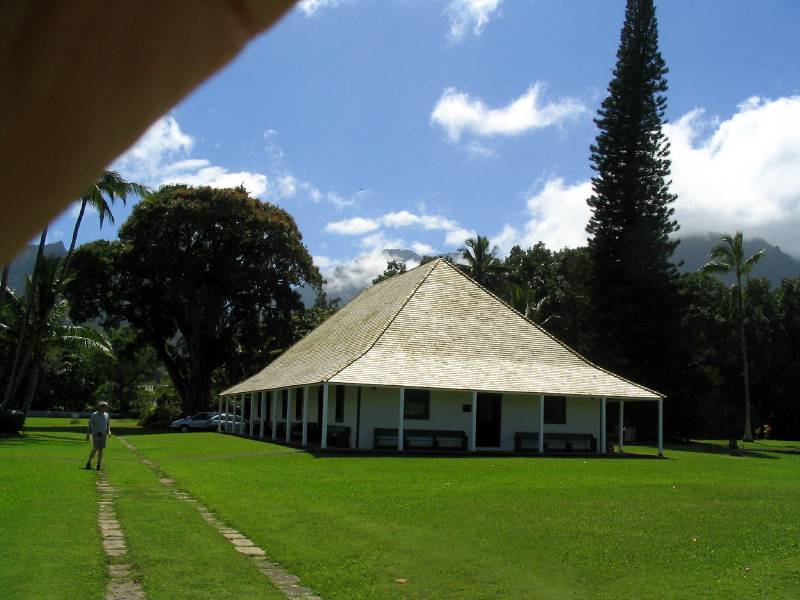
This building is associated with the church , and it dates back to the early Plantation era.
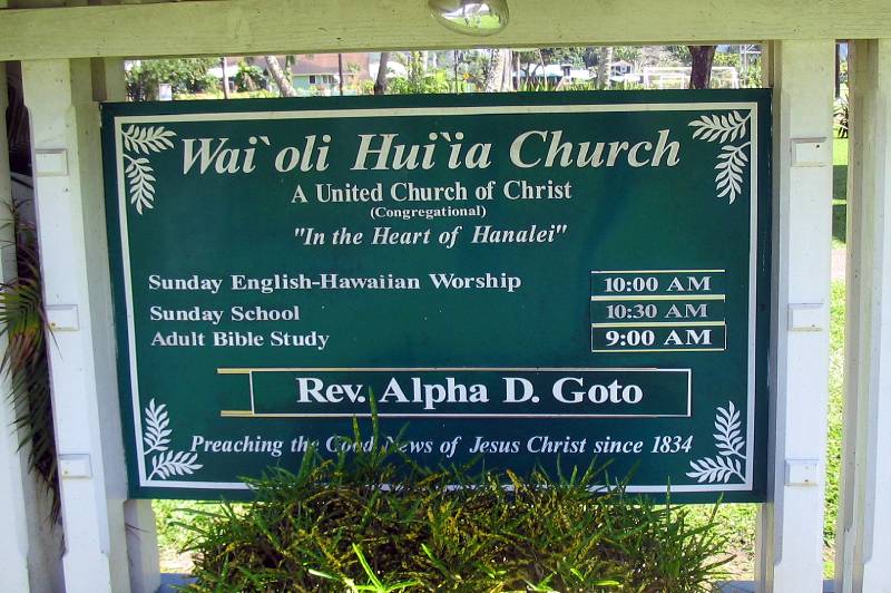
In case you could not figure out which church this was, I have provided this image.
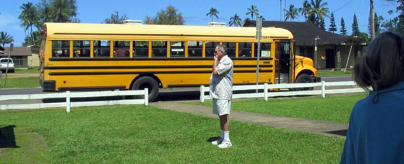
Here is our sturdy yellow school bus. Our driver not only drives the school kids on it, she washes and cleans it every weekend. And she was a great driver, taking us on all sorts of steep curvy back country roads with consummate skill and daring.
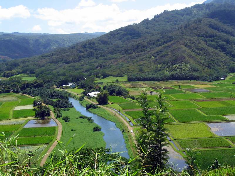
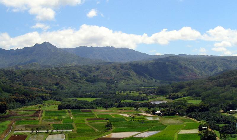
We stopped at this high point to see the cultivated taro fields, that are irrigated by the river. Taro was a main food source for the early inhabitants. It was their equivalent of our potato.
Such a beautiful valley.
|